Diamantina Touring Commpany strongly believe in the value of travel insurance. You can purchase NIB Insurance (Australia Limited) policies issued via the link below. You can use this link to purchase travel insurance not only for Diamantina expeditions, but for any travel you want to do anywhere in the world. This insurance is underwritten by XL Insurance Company SE, Australia branch (ABN 36 083 570 441) A Product Disclosure Statement should be considered before acquiring this product..
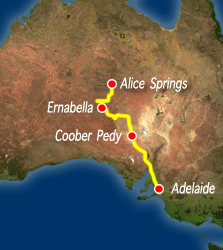
Pitjantjatjara Lands has been described as the jewel in the outback crown. The landscapes in the Everard and Musgrave Ranges are simply stunning. And with a rigorous permit system very few people have the opportunity to see it. Our expedition departs Adelaide and enters the Lands at Indulkana north of Marla Bore. From there we travel through the Everard and Musgrave Ranges. Anangu will show us how to collect bush foods, like witchetty grubs and honey ants. We will see some extraordinary landscapes, mountains, valleys, gorges, waterholes and plains. We will visit rock art sites, and our Anangu hosts will interpret them. In the Everard Ranges there are some wonderful dreaming trails amongst areas of the most extraordinary beauty. The Musgrave ranges rise from the desert to over 4,000'.
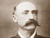
"Everything was of the best kind
here-timber, water, grass, and mountains. In all my wanderings, over thousands of miles in Australia, I never saw a more delightful and fanciful region than this, and one indeed where a white man might live and be happy. The country is excellent, and the scenery most beautiful - pine clad, red, and rocky hills being scattered about in various directions, while further to the west the high, bold, and very rugged chain rose into peaks and points." -Ernest Giles September 1873.
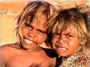
Prior to the Pitjantjatjara Land
Rights, the eastern sideof the lands was primarily pastoral leasehold. In July 1976 the first meeting of the Pitjantjatjara Council was held at Amata For the first time, geographically scattered Pitjantjatjara groups, formally, and of their own accord, articulated to white society that they were one people linked by law and could thus speak with one voice. The Dunstan Government had commenced a process of negotiation and consultation, and when David Tonkin came to power in 1979, he vowed to continue this. After many years of struggle, on 19th. March 1981 the Governor of South Australia consented to the Pitjantjatjara Land Rights Act, and the Anangu took possession of their land..
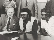
"We got our land back so we can look after all the sacred sites properly and look after other beautiful things on our lands in the same way that a long time ago our people kept them beautifully. And they lived together in various groups, everybody in their family groups, teaching the children well about their grandparents sacred sites and tjukurpa"
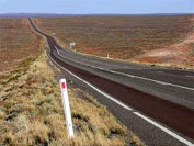
We depart Alice Springs and travel south along the Stuart Highway to Erldunda. We turn on to the Lasseter Highway and head west towards Mt Ebenezer. On Curtain Springs Station we depart the bitumen and head south around the western edge of Mt. Conner the massive Mesa associated with the Ninya, or frost men who create the winter frost and cold winds. At Mulga Park we cross the original Gunbarrel Highway and enter the APY Lands at the South Australian border. We travel southward on seldom trafficked tracks to Ngarutjara. Diamantina first travelled to Ngarutjara back in 1988 and have been regularly visiting the homeland ever since. Ngarutjara is at the foot of the highest mountain in South Australia, Mt Woodruffe, a whopping 1435 meters above sea level.
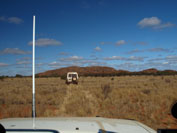
We explore the area around Ngarutjara. We are in the center of a wide valley with massive red mountains enclosing us on three sides. We are camped beside a dry river bed lined with river red gums. We are camped beside a dry river bed lined with river red gums. To the west is Yunanpanya, site of a Little Mouse creation story. Yunanpanya resembles one of the tors of Kata Tjuta, 100kms to the north. We are in the home of Wati Ngintaka, the great Perentie lizard man in the form of Mt Woodruffe. We will visit rock art sites and also enjoy some quiet time in this amazing place.
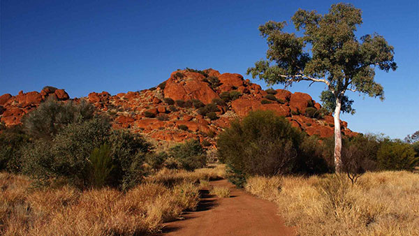
We depart Ngarutjara and head to Pukatja, site of the old Ernabella Mission. We visit Ernabella Arts Inc, which is Australia’s oldest Indigenous art center, and has been in continuous operation since 1948! Originally working in wool, in the 1960s batik was introduced, and in 2003 work began on ceramics. There are also paintings and prints. From Ernabella we track south through the Glen Ferdinand Valley and out onto the plains. We enter the northern extremity of the Great Victoria Desert and swing west to the Everard Ranges and our camp at Victory Well. We are in a valley surrounded by huge red granite boulders. The Everard Ranges are domical inselbergs, huge granite tors that rise abruptly from the surrounding plains. These landforms are also found in places like Wilsons Promontory in Victoria and the New England Plateau (Bald Rock). Here the granite is deep red. The landscape is breathtaking.
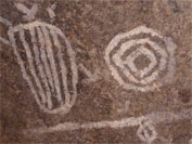
We spend the day travelling along dreaming trails in the Everard Ranges with local Aboriginal guides, through the Sandy Bore Indiginous Protected Area. The Everard Ranges contain many important dreaming lines, or songlines. These stories include the Tjintir-Tjintirpa (willy wagtail) Tjukurpa (dreaming), the Wanampi (watersnake) Tjukurpa and the Walawuru (wedgetail eagle) Tjukurpa. These dreamings are told in the gorgeous landscapes we encounter as well as in numerous and extensive rock art galleries. This day is unforgettable.
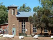
We depart Victory Well and head east to the Stuart Highway. From here we depart the lands and travel on to Alice Springs arriving early evening.
